Yongjie Zheng

Ph.D. Student@unitn.it, Academic Visitor@tu-berlin.de, Master@tongji.edu.cn

bio_1.jpg

Yongjie Zheng is currently a Ph.D. student at Remote Sensing Laboratory (RSLab), University of Trento, advised by Prof. Lorenzo Bruzzone. She was also an academic visitor of Technische Universität Berlin, Germany. Her current research is focusing on AI for Earth and planetary surface mapping.

Her research interests:

  • 🌍 Remote Sensing, Information Fusion, Artificial Intelligence
  • 🛰️ Earth Surface Observation, Deep Space Mapping, Planetary Exploration
  • 📡 Large-scale mapping of Earth and other planets (Lunar, Mars, Asteroid Bennu)


Experiences


Education Experiences

Duration Degree Institution Supervisor GPA (Rank)
2022.12 - Present Ph.D. University of Trento Prof. Lorenzo Bruzzone -
2018 - 2021 M.A. Tongji University Prof. Sicong Liu 4.62/5.00 (1/74)
2014 - 2018 B.E. Henan Polytechnic University - 3.98/5.00 (1/49)

Work & Overseas Experiences

Duration Position Institution Location
2024.09 - 2024.12 Academic Visitor Technische Universität Berlin Germany
2021.06 - 2022.06 Machine Learning Engineer Shanghai Fabric Eyes Artificial Intelligence Technology Co., Ltd China

Project Experiences

  • 2021 – 2024 – National Natural Science Foundation of China (42071324)
    • Designed an automatic shallow-deep feature fusion network for VHR image classification;
    • Designed an automatic multi-temporal feature fusion network for multi-temporal image classification.
  • 2019 – 2022 – National Key R & D Program of China (2018YFB050500)
    • Designed a two-stage multiple feature fusion approach for VHR image classification (based on machine learning);
    • Designed a series of feature fusion networks for VHR image classification (based on deep learning).
  • 2019 – 2020 – Key Laboratory of Cities’ Mitigation and Adaptation to Climate Change in Shanghai, CMACC Open Foundation (QHBHSYS201904)
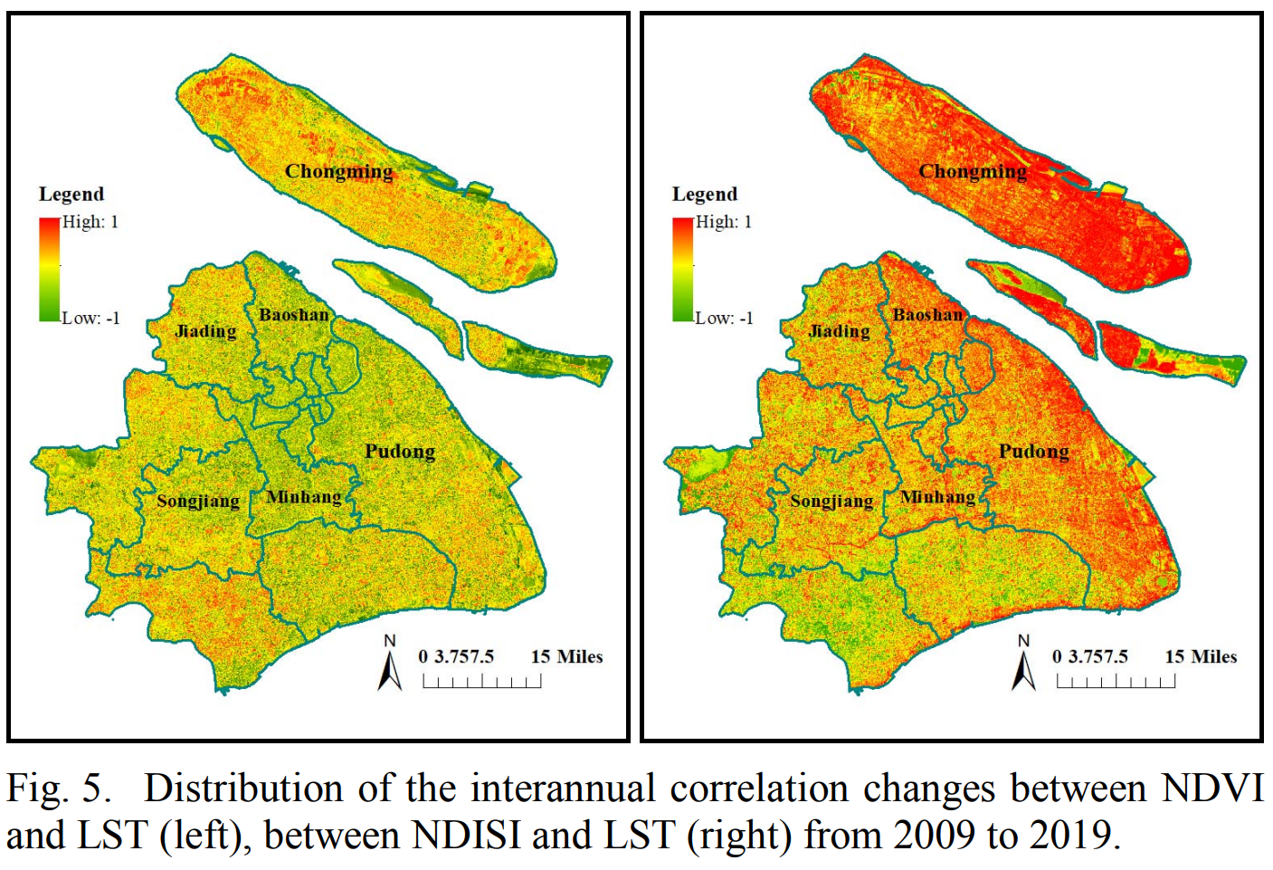
    • Analyzed the spatio-temporal characteristics of urban LULC and LST over Shanghai during 2009–2019.
  • 2018 – 2019 – National Natural Science Foundation of China (41601354)
    • Designed an automatic change detection method for large-scale scene remote sensing images;
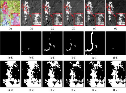
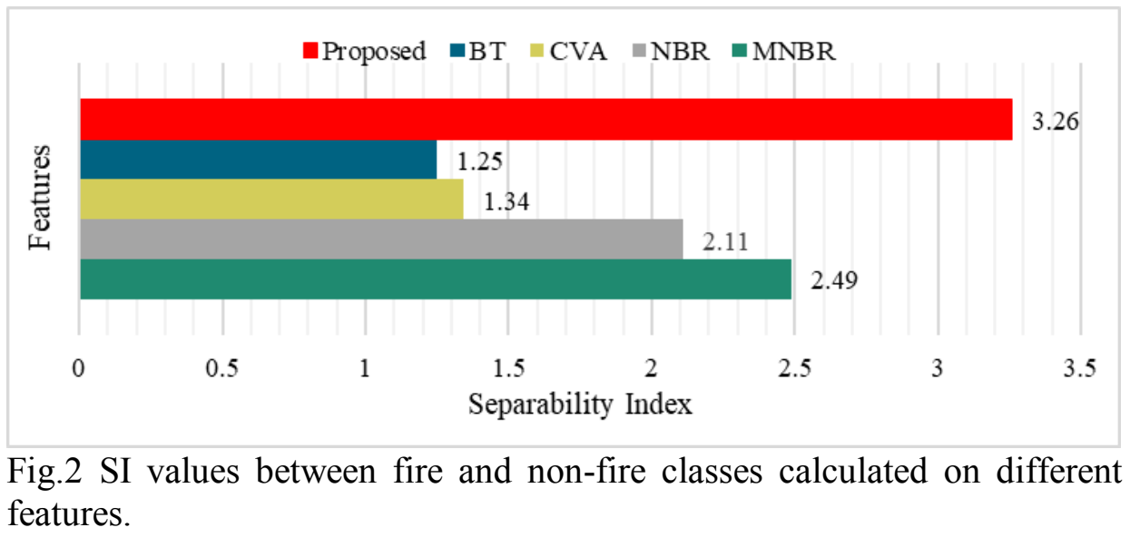
    • Proposed a novel fire index-based burned area change detection approach using Landsat-8 data;
    • Designed a feature fusion method based on Landsat-8 OLI-SWIR and TIRS images for burned area change detection.

Research Activities


Conference Activities

  • 2024 – IGARSS (Oral)
  • 2021 – The 6th National Imaging Spectrum Earth Observation (NISEO) (Oral)
  • 2020 – IGWG (Oral)
  • 2019 – MultiTemp (Oral & Volunteer)
  • …

Reviewing Activities

  • ISPRS Journal of Photogrammetry and Remote Sensing
  • IEEE Transactions on Geoscience and Remote Sensing (TGRS)
  • IEEE Journal of Selected Topics in Applied Earth Observations and Remote Sensing (JSTARS)
  • IEEE Geoscience and Remote Sensing Letters (GRSL)
  • SPIE Journal of Applied Remote Sensing (JARS)
  • …

Selected Publications

  1. IEEE_TGRS
    chen2024ELunarDTMNet.png
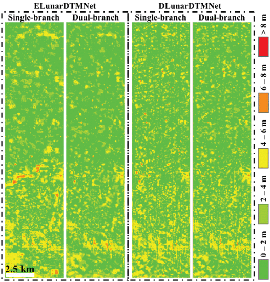
    ELunarDTMNet: Efficient Reconstruction of High-Resolution Lunar DTM From Single-View Orbiter Images
    Hao Chen, Philipp Gläser, Xuanyu Hu, Konrad Willner, Yongjie Zheng†, Friedrich Damme, Lorenzo Bruzzone, and Jürgen Oberst
    IEEE Transactions on Geoscience and Remote Sensing (IEEE_TGRS), 2024
  2. IEEE_IGARSS
    zheng2024ETD.png
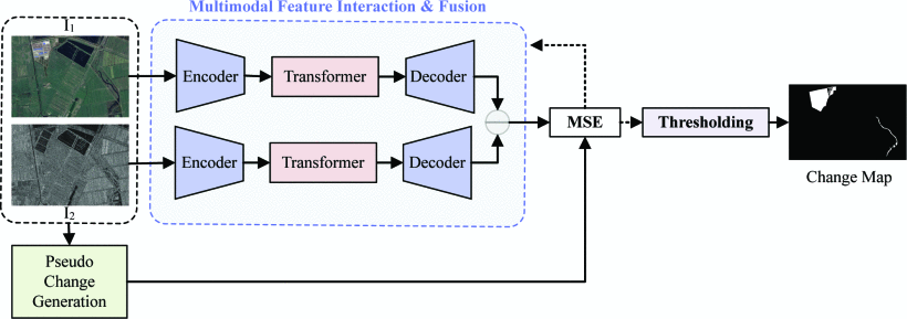
    A Transformer-Enhanced Encoder-Decoder Network For Unsupervised Heterogeneous Remote Sensing Image Change Detection
    Yongjie Zheng, Sicong Liu, and Lorenzo Bruzzone
    In IEEE International Geoscience and Remote Sensing Symposium (IEEE_IGARSS) , 2024
  3. IEEE_TGRS
    zheng2024HFN.png
    Hybrid FusionNet: A Hybrid Feature Fusion Framework for Multisource High-Resolution Remote Sensing Image Classification
    Yongjie Zheng, Sicong Liu, Hao Chen, and Lorenzo Bruzzone
    IEEE Transactions on Geoscience and Remote Sensing (IEEE_TGRS), 2024
  4. IEEE_GRSL
    zheng2023AeF2N.png
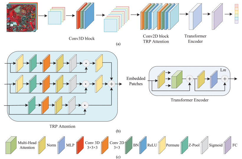
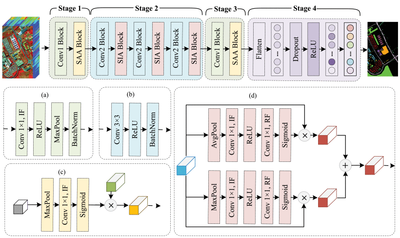
    An Attention-Enhanced Feature Fusion Network (AeF2N) for Hyperspectral Image Classification
    Yongjie Zheng, Sicong Liu, and Lorenzo Bruzzone
    IEEE Geoscience and Remote Sensing Letters (IEEE_GRSL), 2023
  5. ERS
    liu2023.png
    Remote Sensing Change Detection Technology in the Era of Artificial Intelligence: Inheritance, Development and Challenges
    Sicong Liu, Kecheng Du, Yongjie Zheng, Jin Chen, Peijun Du, and Xiaohua Tong
    Journal of Remote Sensing (ERS), 2023
  6. IEEE_TGRS
    liu2022SDF2N.png
    A Shallow-to-Deep Feature Fusion Network for VHR Remote Sensing Image Classification
    Sicong Liu, Yongjie Zheng‡†, Qian Du, Lorenzo Bruzzone, Alim Samat, Xiaohua Tong, Yanmin Jin, and Chao Wang
    IEEE Transactions on Geoscience and Remote Sensing (IEEE_TGRS), 2022
  7. IEEE_JSTARS
    zheng2021MDFN.png
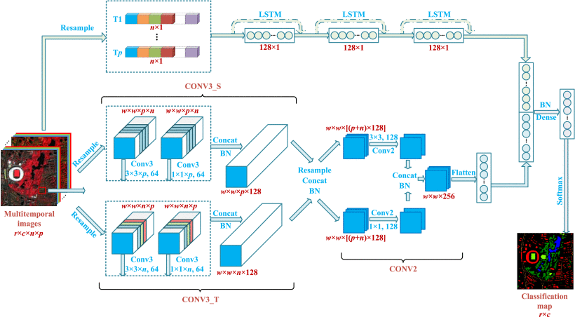
    A Novel Multitemporal Deep Fusion Network (MDFN) for Short-Term Multitemporal HR Images Classification
    Yongjie Zheng, Sicong Liu, Qian Du, Hui Zhao, Xiaohua Tong, and Michele Dalponte
    IEEE Journal of Selected Topics in Applied Earth Observations and Remote Sensing (IEEE_JSTARS), 2021
  8. IEEE_JSTARS
    zheng2021TsF_.png
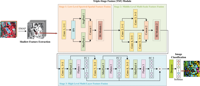
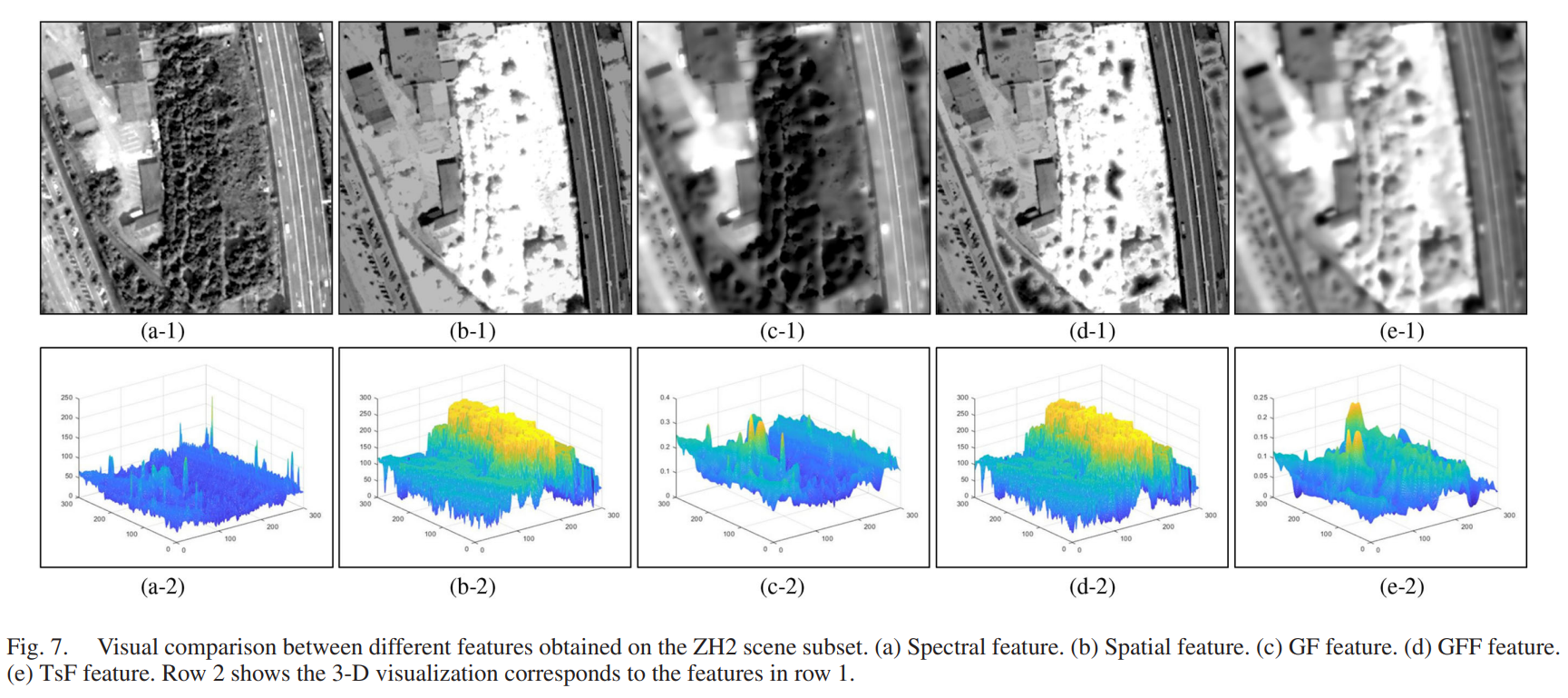
    A Novel Feature Fusion Approach for VHR Remote Sensing Image Classification
    Sicong Liu, Yongjie Zheng‡†, Qian Du, Alim Samat, Xiaohua Tong, and Michele Dalponte
    IEEE Journal of Selected Topics in Applied Earth Observations and Remote Sensing (IEEE_JSTARS), 2021
  9. EJRS
    liu2020.png
    A novel fire index-based burned area change detection approach using Landsat-8 OLI data
    Sicong Liu, Yongjie Zheng‡, Michele Dalponte, and Xiaohua Tong
    European Journal of Remote Sensing (EJRS), 2020
  10. MultiTemp
    zheng2019.png
    Analyzing spatio-temporal characteristics of urban LULC and LST over Shanghai during 2009–2019
    Yongjie Zheng, Sicong Liu, Zhengxiang Song, Xiaohua Tong, and Huan Xie
    In International Workshop on the Analysis of Multitemporal Remote Sensing Images (MultiTemp) , 2019
  11. IEEE_IGARSS
    zheng2019igarss.png
    Feature-Level Fusion of Landsat-8 OLI-SWIR and TIR Images for Fine Burned Area Change Detection
    Sicong Liu, Yongjie Zheng‡, Michele Dalponte, Xiaohua Tong, and Qian Du
    In IEEE International Geoscience and Remote Sensing Symposium (IEEE_IGARSS) , 2019